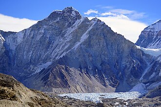
Limi Valley: a detailed Nepal travel guide
Limi Valley is a challenging Journey Vibes programme in Nepal's Humla landscape. This guide explains the researched route framework, preparation requirements, seasonal considerations, and responsible-travel expectations before you book.
The itinerary is representative rather than a guaranteed departure schedule. Weather, road conditions, domestic flights, acclimatization, lodge availability, permits, local authority decisions, and guide safety decisions can change the final sequence. Your guide and operations team must confirm the final plan before departure.
At a glance
- Typical duration: 18 days in the current Journey Vibes programme
- Difficulty: challenging
- Region: Humla
- Highest point listed: 4,100 m
- Best-season field: March to May
- Travel style: Guided, small-group, safety-aware travel with locally confirmed lodging and route decisions
Detailed day-by-day route
Day 1: Simikot–Dharapuri
Route stage: Karnali valley trail. Overnight: Dharapuri. Approximate altitude: about 2,300. This is a representative stage, not a guaranteed departure schedule. Research sources: https://www.immigration.gov.np/en/page/trekking-permit; https://www.nepalhikingteam.com/limi-valley-trek/
- Simikot–Dharapuri
- Karnali valley trail
Overnight: Dharapuri.
Day 2: Dharapuri–Kermi
Route stage: Karnali villages and hot springs. Overnight: Kermi. Approximate altitude: about 2,670. This is a representative stage, not a guaranteed departure schedule. Research sources: https://www.immigration.gov.np/en/page/trekking-permit; https://www.nepalhikingteam.com/limi-valley-trek/
- Dharapuri–Kermi
- Karnali villages and hot springs
Overnight: Kermi.
Day 3: Kermi–Muchu/Yari
Route stage: Upper Karnali and Humla road corridor. Overnight: Muchu or Yari. Approximate altitude: variable. This is a representative stage, not a guaranteed departure schedule. Research sources: https://www.immigration.gov.np/en/page/trekking-permit; https://www.nepalhikingteam.com/limi-valley-trek/
- Kermi–Muchu/Yari
- Upper Karnali and Humla road corridor
Overnight: Muchu or Yari.
Day 4: Yari–Hilsa
Route stage: Nara La/upper Karnali approach; route varies. Overnight: Hilsa. Approximate altitude: Nara La about 4,620. This is a representative stage, not a guaranteed departure schedule. Research sources: https://www.immigration.gov.np/en/page/trekking-permit; https://www.nepalhikingteam.com/limi-valley-trek/
- Yari–Hilsa
- Nara La/upper Karnali approach; route varies
Overnight: Hilsa.
Day 5: Hilsa–Til
Route stage: Limi Valley entry and Tibetan-style villages. Overnight: Til. Approximate altitude: about 3,700. This is a representative stage, not a guaranteed departure schedule. Research sources: https://www.immigration.gov.np/en/page/trekking-permit; https://www.nepalhikingteam.com/limi-valley-trek/
- Hilsa–Til
- Limi Valley entry and Tibetan-style villages
Overnight: Til.
Day 6: Til–Halji
Route stage: Limi Khola, Halji monastery. Overnight: Halji. Approximate altitude: about 3,660. This is a representative stage, not a guaranteed departure schedule. Research sources: https://www.immigration.gov.np/en/page/trekking-permit; https://www.nepalhikingteam.com/limi-valley-trek/
- Til–Halji
- Limi Khola, Halji monastery
Overnight: Halji.
Day 7: Halji–Jang
Route stage: Limi villages and barley fields. Overnight: Jang. Approximate altitude: about 3,930. This is a representative stage, not a guaranteed departure schedule. Research sources: https://www.immigration.gov.np/en/page/trekking-permit; https://www.nepalhikingteam.com/limi-valley-trek/
- Halji–Jang
- Limi villages and barley fields
Overnight: Jang.
Day 8: Jang–Nyalu La approach
Route stage: High pass approach. Overnight: Camp. Approximate altitude: variable. This is a representative stage, not a guaranteed departure schedule. Research sources: https://www.immigration.gov.np/en/page/trekking-permit; https://www.nepalhikingteam.com/limi-valley-trek/
- Jang–Nyalu La approach
- High pass approach
Overnight: Camp.
Day 9: Nyalu La–Kermi/Simikot direction
Route stage: Nyalu La crossing, snow/weather-dependent. Overnight: Camp/Kermi. Approximate altitude: Nyalu La about 4,990. This is a representative stage, not a guaranteed departure schedule. Research sources: https://www.immigration.gov.np/en/page/trekking-permit; https://www.nepalhikingteam.com/limi-valley-trek/
- Nyalu La–Kermi/Simikot direction
- Nyalu La crossing, snow/weather-dependent
Overnight: Camp/Kermi.
Day 10: Return to Simikot
Route stage: Karnali valley return. Overnight: Simikot. Approximate altitude: about 2,910. This is a representative stage, not a guaranteed departure schedule. Research sources: https://www.immigration.gov.np/en/page/trekking-permit; https://www.nepalhikingteam.com/limi-valley-trek/
- Return to Simikot
- Karnali valley return
Overnight: Simikot.
How to prepare
Build walking fitness gradually before departure, including consecutive days on uneven terrain and controlled uphill/downhill work. Pack layers, rain protection, sun protection, a reusable water system, reliable footwear, personal medication, and a small headlamp. Your exact equipment list depends on elevation, camping requirements, season, and whether the route includes a high pass or technical climbing section.
For high-altitude routes, plan conservatively. Tell the guide immediately about headache, nausea, unusual fatigue, poor coordination, breathlessness, or worsening sleep. Do not ascend simply to keep to a schedule. A rest day, descent, route change, or evacuation decision may be the safest outcome.
Permits, access, and seasonal planning
Permit names, fees, guide rules, restricted-area requirements, conservation-area charges, and TIMS requirements can change. The sources below are starting points for research, not a substitute for a current permit check. Journey Vibes should confirm the exact route, applicable authority, current fees, and transport conditions before issuing final departure documents.
Spring and post-monsoon autumn are generally the most reliable periods for Himalayan trekking. Monsoon can bring rain, leeches, landslides, road closures, and poor visibility. Winter may be excellent in lower valleys but can make high passes, high camps, and remote lodges unsafe or unavailable.
Responsible travel
Stay on established trails, minimise single-use plastic, use safe water practices, respect monasteries and local customs, ask before photographing people, and support locally owned guides, lodges, porters, and community services. Carry waste back to an appropriate collection point and follow protected-area rules for wildlife and fire.
Frequently asked questions
Is this exact itinerary guaranteed?
No. It is a researched typical framework. The final schedule is confirmed after checking current weather, transport, permits, health, and trail conditions.
Do I need a guide?
Requirements vary by route and current government rules. Restricted areas and many remote routes require a licensed agency and guide. Journey Vibes should verify the current rule for the selected departure.
Can the route be shortened?
Some routes can be shortened through road access or by removing side trips, while high-altitude routes should not be shortened by removing acclimatization days without a qualified safety review.
Research sources
- https://www.immigration.gov.np/en/page/trekking-permit
- https://www.nepalhikingteam.com/limi-valley-trek/
Last content review: 3 August 2026. Reconfirm permits, fees, access, weather, and accommodation before sale or departure.